Mobile Device Tools Software RSS Reupload Requests 32
-
File Size: 8.4 GB
This is Best Paid Android Applications With Last Update.
-

Requirements: Android 4.4+ | File size: 12.1 MB
Fast & free movies and tv shows. FilmPlus is a brand new Android application to watch free movies and tv shows on Android phones, Android TVs and Amazon Firesticks.
-

Requirements: Android 4.4+ | File size: 12.8 MB
It is specifically created for mobile devices to ensure accurate and reliable results. Great for gamers and VOIP users to test connections : Users can choose to test the speed to servers located Worldwide. Including UK, USA, EU, Far East and South America. Your results history shows Wi-Fi and mobile/LTE results. Identify the fastest providers in your area using our dynamic results map to compare results in your area.
-

Requirements: Android 7.0+ | File size: 18.2 MB
Smart Launcher is back and has been completely renewed! Smart Launcher is the innovative launcher that makes your smartphone or tablet faster and easier to use.
-
Requirements: Android 6.0+ | Size: 2.35 MB
-
Requirements: Android 5.1+ | Size: 19.6 MB
-
Requirements: Android 5.0+ | Size: 3.81 MB
-

Requirements: Android 6.0+ | File size: 116 MB
Weather alerts from AccuWeather are superior in their accuracy. Whether it’s wind, sun or rain, you can stay one step ahead with AccuWeather’s weather radar. Be prepared for the daily forecast or sudden changes in weather with live alerts and accurate weather forecasts. Daily weather snapshots provide storm alerts, weather updates and RealFeel Temperature®, making today’s weather predictable.
-
Requirements: Android 5.0+ | File size: 29 MB
Free, secure and simple, manage your files efficiently and easily with ESuper File Explorer. ESuper File Explorer is a simple and powerful file explorer for Android devices. It's free, fast and fully functional.
-

Requirements: Android 5.0+ | File size: 5.72 MB
Total launcher is the best customizable launcher in Android. Of course, it is still fast, light and easy to use.
-

Requirements: Android 4.1+ | File size: 6.7 MB
App Backup Restore use accessibility services to improve auto uninstall feature in some devices. App Backup Restore - Transfer is to Backup & Restore apps and personal (contacts/SMS/call) to local or cloud, Transfer & Share apps, personal information for Android devices.
-

Requirements: Android 7.0+ | File size: 147.5 MB
Filmora video editor (Former name, FilmoraGo video editor) - an easy-to-use video editor and movie maker for YouTube and Tik Tok with over 1000 music, over 5000 stickers and filters, text, audio, emoji, backgrounds, etc. Just trim the clips, add music, transition effects, text, emoji and filters to create incredible videos in minutes. Templates help you create your own movies on TikTok, Instagram Reels, YouTube or wherever you like! You’ll save time and have a blast with Filmora video editor.
-

Requirements: Android 5.0+ | File size: 23.8 MB
What if you find your Android devices were able to control your TV? Try this Remote Control for All TV app which converts your Android device to a universal remote.
-
Requirements: Android 5.0+ | Size: 14.4 MB
-
Requirements: Android 5.0+ | Size: 38.7 MB
-
Requirements: Android 5.0+ | Size: 30.5 MB
-
Requirements: Android 4.4+ | Size: 22.9 MB
-
Requirements: Android 4.4+ | File size: 5.97 MB
RARLAB's RAR is an all-in-one, original, free, simple, easy and quick compression program, archiver, assistant, extractor, manager and even a basic file explorer.
-

Requirements: Android 6.0+ | File size: 331 MB
OsmAnd+ (OSM Automated Navigation Directions) is a map and navigation application with access to the free, worldwide, and high-quality OpenStreetMap (OSM) data. Enjoy voice and optical navigation, viewing POIs (points of interest), creating and managing GPX tracks, using contour lines visualization and altitude info, a choice between driving, cycling, pedestrian modes, OSM editing and much more.
-
File size: 37 MB
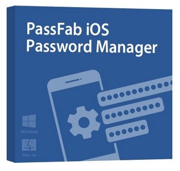
This best iOS password manager helps you to find Wi-Fi password back, recover lost website and App password, view mail account password, show Apple ID and password, display credit card information, figure out Screen Time passcode and export password to CSV file.